 |
Image Credit: WeatherByWaters on X |
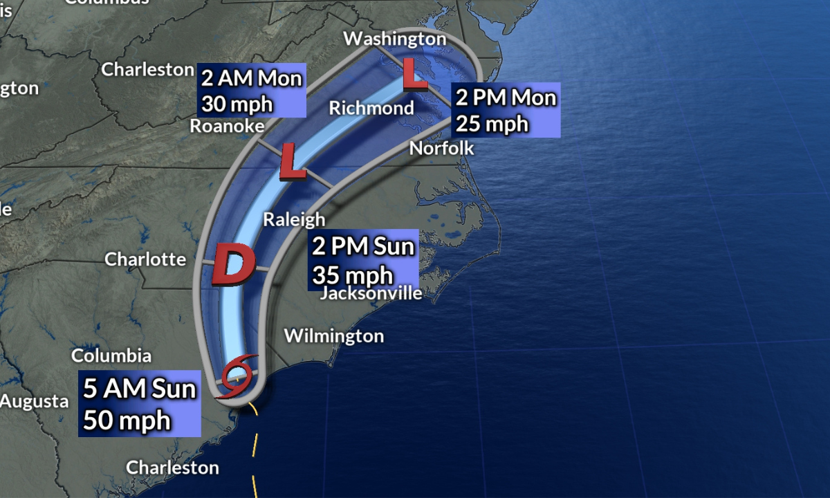
Winston‑Salem, NC — As the remnants of Tropical Storm Chantal move northward, central North Carolina—particularly the Triad region—faces a widespread threat of heavy rainfall and flash flooding on Sunday, July 6. The Chantal storm path has shifted inland after landfall along the South Carolina coast, bringing significant weather risks to the Carolinas.
Early Sunday morning, Chantal made landfall near Myrtle Beach, South Carolina, with sustained winds around 50 mph. Although the system is weakening, it remains capable of producing dangerous conditions as it moves through North Carolina.
Meteorologist Dylan Hudler from WXII forecasted that the Triad would experience the most severe impact during the afternoon and early evening hours. The Chantal storm path is expected to carry rain bands over the eastern Triad and into the Raleigh‑Durham area, with rainfall totals ranging between 2 to 4 inches and isolated areas potentially seeing up to 6 inches. These conditions elevate the risk of flash flooding, especially in urban and low-lying zones.
The heaviest downpours are forecasted to arrive between 3 p.m. and 8 p.m. on Sunday. Along with the rain, breezy conditions will prevail, although wind gusts in the Triad should stay below 30 mph. Coastal areas will likely feel the brunt of the wind, with gusts reaching 50 to 57 mph and wave heights between 8 and 10 feet, creating hazardous marine and beach conditions.
Authorities are urging residents to remain alert and avoid driving through flooded roadways. The National Weather Service has issued flash flood watches for many counties within the Chantal storm path, advising people to monitor local alerts closely. Hudler emphasized that while not all areas will see heavy rainfall, those that do may experience significant flooding in a short time.
By late Sunday night into Monday morning, Chantal’s remnants are expected to weaken into a post-tropical low, with clearing skies and more typical summer weather returning by the start of the workweek.
What Residents Should Know:
- Timing: Rain is expected to intensify from 3–8 p.m. on Sunday.
- Rainfall: 2–4 inches common; isolated areas may see 6 inches.
- Wind: Gusts below 30 mph inland, up to 57 mph near the coast.
- Flood Risk: Flash flooding possible along the Chantal storm path—especially in the Triad and eastward.
Residents are advised to prepare for possible flooding and check updates frequently as the Chantal storm path continues to affect the region.
Post a Comment
Post a Comment